Sunday 22 December 2019

An Acrostic Seasonal history of the Casey Cardinia region - Festive Season!

We take an acrostic, historic and eclectic look at the Casey Cardinia region looking at themes suggested by the letters in Festive Season. In 2018, we looked at Holidays, and in 2016, we did Merry Christmas and Happy New Year.

F is for Females. Traditionally women were hidden from history, as many history books concentrated on public history - politicians, business owners, explorers etc - and they all tended to be men, while the women stayed in the background raising families, prevented from voting or standing for Council amongst other impediments to public life. Here are some of my favourite women - Sarah Fagan - hotel keeper and shipwreck survivor from Lyndhurst; Eliza Gooch another publican and ship wreck survivor; Elizabeth Andrews - a farmer from Hallam; Sister Hollis and Sister Lewis, Infant Welfare Centre Nurses at Pakenham and Kathleen Kinsella, Army Nurse.


Sarah Fagan

E is for Ewes and rams - or sheep as they are collectively known.  We don't really consider this a sheep growing area - it's more of a Western District activity - but we did have  an early sheep industry. The book Rural Industry in the Port Phillip Region, 1835 - 1880 by Lynnette J. Peel (Melbourne University Press, 1974) lists livestock numbers in selected areas. These are the sheep figures in the Berwick region - 1856/57 - 1,600; 1859/60 - 2,597; 1871 - 10, 994 and 1880/81 - 30,777. In comparison here are the cattle figures - 1856/57 - 4,212; 1859/60 - 15,438; 1871 - 20,406 and 1880/81 - 22,149. As you can see sheep farming in the area took off in the 1870s, however these sheep numbers were dwarfed by areas such as Sunbury and Bannockburn which in 1880 each had over 116,000 of the animals. Some of the early sheep farmers were William Lyall, who farmed Cotswald sheep in the 1850s at his Yallock and Tooradin properties; Duncan MacGregor breed Leicester sheep in the 1870s at his Dalmore property and Alexander McMillan who had Merinos at his Caldermeade property. Rural Industry in the Port Phillip Region, 1835 - 1880 is an interesting book, I will do a post on it one day

S is for Shows - Agricultural Shows. The earliest show society was the Mornington Farmers' Society (Mornington being the County of Mornington, the land administration area that covers this district) established in 1856. They held their first show, in the form of a ploughing match,  in 1857 at Mr Walton's farm at Narre Warren -  now the location of the Fountain Gate Shopping Centre. The 1858 show was held at the farm of the Reverend Alexander Duff in Cranbourne. Read about these shows, here. The  Mornington Farmers' Society became the Berwick and District Agricultural and Horticultural Society in 1918.

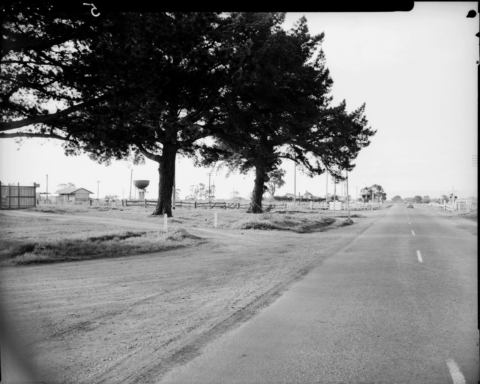
T is for Trees - The first thing about trees that comes to mind is the notable tree grower, Carl Nobelius  Carl started the Gembrook Nursery at Emerald in 1886. Nobelius produced  a yearly catalogue and by 1903 Nobelius was advertising over one million trees for sale and this had increased to three million trees just before the First World War. The nursery concentrated on fruit and ornamental trees and supplied trees world wide, including to South Africa to replant their orchards after the Boer War. Read more about the Nursery on the Emerald Museum website, here. Another significant set of trees are the Oak trees that line the Princes Highway at Narre Warren, planted in 1890 by Sidney Webb. You can read about them here. The trees were supplied by the Nobelius Gembrook Nursery.The area also has some Avenues of Honor, planted in memory of Great War Soldiers. I have written about some of them here. The City of Casey have also published a booklet on their Avenues, Our Living Memorials, read it here.


The Nursery at Emerald. Photographer: Rose Stereograph Co.
State Library of Victoria Image H2001.88/10

I is for Infant Welfare Centres. The Baby Health Care movement began in Victoria in June 1917 when Dr Isabella Younger Ross opened a centre in Richmond. She was one of many experts who   emphasised the importance of teaching women hygiene, nutrition etc with the ultimate aim of lowering the child mortality rates. Infant Welfare Centres started a bit later in this area than in the City and the first mention I could find was in 1935 when both Garfield and Bunyip had a Centre. Read more here.  They are interesting because many of these buildings were established due to women organising local committees to fund raise for the buildings and once they were opened women were on the Committees to manage the operation of the service. One of the more unusual Infant Welfare Centres in the area is the one at Emerald. It was opened in March 13, 1940 and built in the Art Deco style.

V is for Volcanoes. On Wednesday, August 17, 1904, Mr J.H.L. Morgan gave  a lecture at the Berwick Mechanics' Institute on Geology. You can read the report in the South Bourke & Mornington Journal, here. This is part of Mr Morgan's talk - We had at least several distinct periods of volcanic activity, that latest being the great lava flows which spread over the whole of the south western part of the State. Berwick, Cranbourne, Flemington and Collingwood are instances of older volcanic periods. It was explained that Berwick hill was not an extinct volcano as is commonly supposed, but a dome of concretionary lava, the result of some plutonic force. From the hills here may be had a splendid view of the great valley of Victoria which extends from the far western boundary right through to the Gippsland Lakes. The southern boundary of this valley is almost worn away, probably as a result of the great subsidence which resulted in is Bass Strait. The Otway Ranges and the South Gippsland Ranges only remain. Striking evidence of volcanic activity existed in Narre Warren  North in the form of columnar basalt, part of an thick lava flow. You can read about this here.

E is for Entertainment - the Movies or Picture Theatres.  The 1920s was a boom time for Picture Theatres. The Garfield Picture Theatre opened with a Grand Ball on Monday, December 22, 1924. Apart from the Picture Theatre locals could also view movies at the Wattle Theatre at Koo Wee Rup, which opened July 1927 and King’s Picture Theatre at Pakenham which opened September 7, 1927. Harrington’s Electra Pictures had been shown at the Garfield Hall and films were shown at Tynong - there is still a bio box or projection room, which is currently inaccessible, at the Hall.  The original Bunyip Hall also showed movies however, when it burnt down in March 1940, the ‘picture plant’ was destroyed. The Garfield Theatre closed in the early 1960s although it did reopen weekends in 1970 and 1971. There was also a picture theatre at Berwick, it was built by the owners of the Pakenham Picture Theatre and opened September 5, 1928.


Garfield Picture Theatre, 1920s.
Image: Koo Wee Rup Swamp Historical Society

S is for Seaside resorts - Tooradin and Lang Lang. Not quite miles of golden sand beaches, more Western Port mudflats, but we used to to go to Tooradin for swimming and water skiing, when I was a girl in the 1960s and 1970s. The Lang Lang beach hosted the annual Sun newspaper Beach Girl contest in the 1950s, the winner of this and other local competitions then competed for the State title.  This competition was hotly contested and women came from everywhere to compete - the 1952 winners were Miss Joan McDonald, of Elwood, with Miss Vilma Rennell, of Glen Iris, and Miss Beth Clyno, of Loch, second and third respectively (Dandenong Journal, January 30, 1952). The Beach Girl competition was one of the ways the community raised money to construct the  Lang Lang swimming pool at the beach which opened on New Years Day in 1956. The local State Schools held their swimming carnivals there. The Lang Lang Pool was closed after the opening of the Koo Wee Rup pool in February 1975.

Lang Lang Beach Girl competition report
Weekly Times  January 23, 1952   http://nla.gov.au/nla.news-article224014906

E is for Explorers - and it is also for the book Early Days of Berwick, which is full of interesting information, including this - Mrs Fanny Hume Hutchinson, who was a resident in Peel Street, Berwick, for twenty-nine years, was the granddaughter of Hamilton Hume, the early explorer who came to Australia in 1790 and with Hovell made their memorable journey to Port Phillip in 1824Early Days of Berwick also tells us Mr James W. Ogilvy and his family lived on Buchanan's Road for many years. The son of one of Melbourne's earliest solicitors Mr Ogilvy .....witnessed the departure of Burke and Wills Expedition in 1860.

A is for Accouchement - or giving birth. A dangerous occupation in the past (and still is in many third world and war torn countries). Large families were the norm in the 1800s. For instance, Catherine Bourke, who with her husband Michael established the La Trobe Inn, on the Toomuc Creek in Pakenham  in 1849, had 14 children between 1839 and 1864. Susan Bain, who operated the Berwick Inn on High Street Berwick had eleven children between 1860 and 1880, of which eight pre-deceased her.  Australian figures show that  maternal mortality remains high at 500 to 600 per 100,000 live births until 1937. In 1937, the maternal mortality drops, and continues to tumble in quite an extraordinary way to reach around 109/100,000 by 1950, and below 10/100,000 by 1975 (1). Those early figures mean five mothers would die for every 1,000 live births. According to recent Government figures the maternal mortality rate for 2012 - 2014 is now 6.8 per 100,000.

Even if the mother survived the birth process, the baby often didn't. Infant Mortality rates have dropped from an average of  120 from 1870 to 1910,  to an average of 70 in the 1910s, 31 in the 1940s and 13 in the 1970s. It is now around 3.  The Infant Mortality rate is the number of infant deaths in a year per thousand births registered that year. So in the 1870s to the 1890s - each year on average 120 babies under the age of one would die out of every 1,000 born (2).


Susan and Robert Bain and their family in the 1880s, showing their nine surviving children. 
Image:  Berwick Mechanics' Institute and Free Library by Richard Meyers. 

S is for Stones - gem stones. The most obvious place you might search for gems would be Gembrook. Gembrook was named by Albert Le Souef who was a member of  a mining syndicate searching for gemstones in a creek, four miles west of William Wallace Creek, in the 1870s. Le Souef named this creek Gem brook. Emeralds, garnets and sapphires were apparently found in these creeks. This information comes from the history of Gembrook, written by Genseric Parker, Forest to Farming.  All sorts of gemstones can still be found in the creeks - Cardinia Creek and Wallace Creek, west and east, of Gembrook respectively, are known sources of sapphires, topaz, amethysts, agates and pebbles of variously coloured chalcedony....Zircon and cassiterite are also reported in the Gembrook area... sapphires, zircons, tourmaline and agate are reported at Berwick. This is according to the book How and where to find Gemstones in Australia and New Zealand edited by Bill Myatt (Lansdown Press, 1987). Happy fossicking, but before you go and seek your fortune in the local creeks - you will need a permit - all the details on 'Recreational fossicking' are here.


Zircon gems found in the Bunyip River (eastern branch), 17 km north of Longwarry. Photographer: Frank Coffa.

O is for On the Beach - the book and the film. On the beach was  a novel written by Nevil Shute when he was living at Langwarrin, then part of the Shire of Cranbourne. It was published in 1957. It was later made into a film, some of which was filmed at George Wilson's property in Berwick. Shute Avenue and Kramer Drive in Berwick are permanent reminders of this filming - Shute being named after the author and Kramer, after Stanley Kramer, the Producer. The filming in Berwick took place in January 1959 in very hot conditions - it was over 40 degrees. You can read more about Nevil Shute and the filming, here.  You can read about the making of the film in this account written by Philip Davey, here https://2015.acmi.net.au/acmi-channel/2009/film-essay-on-the-beach/  Philip Davey is the author of the book When Hollywood came to Melbourne : the story of the making of Stanley Kramer's On the beach, published in 2005.


Filming On the Beach at the Wilson property in Berwick, January 1959.
Image: donated to the Casey Cardinia Library Archive by the Wilson family.

N is for Florence Nightingale. We return to Early Days of Berwick for this link to Florence Nightingale (1820 - 1910) - nursing pioneer who formalised nursing education and established standards of care for patients and standards of hygiene for hospitals. From Early Days of Berwick - Two Crimean War Veterans, Mr Drummond and Mr Adams, resided in High Street, Berwick. These two old gentlemen wearing their Crimean War medals, could often be observed sitting in the Boulevard, enjoying the sunshine. It was said that Mrs Drummond was contemporary with and associated with Florence Nightingale, nursing at the Crimea. A report in the South Bourke and Mornington Journal of August 10, 1911 said that Tom Drummond celebrated his golden wedding anniversary on Friday evening and Private Tom wears a couple of Crimean medals of which he is justly proud (see article here) So, now we know Mrs Drummond's husband was called Tom and according to the Electoral Roll, her name was Mary, however that is all I know about this couple - what interesting stories they would have to tell.

Have  a wonderful FESTIVE SEASON

........................................................................................................................
Footnotes for A is for Accouchement
(1) The Australian mortality decline: all-cause mortality 1788 - 1990 by Richard Taylor and Milton Lewis - Department of Public Health and Community Medicine, University of Sydney and John Powles - Institute of Public Health, Department of Community Medicine, University of Cambridge, England. Published in the Australian and New Zealand Journal of Public Health -  1998 Vol. 22 No. 1

(2) Australians: Historical Statistics edited by Wray Vamplew (Fairfax, Syme and Weldon, 1987) These are the Victorian figures. Interesting they vary quite  a bit within each decade - for instance the figures for Victoria for the 1890s are - 1890 - 117.4; 1891- 126.2; 1892 - 106.8; 1893 - 117.7; 1894 - 104.1; 1895 - 102.4; 1896 - 110.0; 1897 - 103.3; 1898 - 134.4; 1899 -114.2.  In 1959, the year I was born, the rate in Victoria was 21.2

Tuesday 10 December 2019

Mrs Edgar Walker, Pen Bryn, Beaconsfield Upper

On December 27, 1904, according to the post mark,  this postcard was sent from Torquay, in England,  to Mrs Edgar Walker, Pen Bryn, Beaconsfield Upper. It is  a delightful postcard -  a self-portrait of Elisabeth Lebrun. Elisabeth (1755 - 1842) was  a popular French portrait artist who painted Marie Antionette over 20 times.


The card reads - Torquay 1st January 1905 - "A bright and Happy New Year to you" - the initials appear to be FMW.  


So who is Mrs Edgar Walker and what is Pen Bryn? We will start with Pen Bryn (Welsh for top of the hill) - it is the name of a house. The original building on the site was  Beaconsfield House which was built by William Brisbane (1842 - 1910) in 1877, on the highest point in the town on what was to become St Georges Parade and Salisbury Road. Most of the building was destroyed by fire on the night of May 30, 1893. Beaconsfield House was where the journalist, The Vagabond, based himself when he visited and wrote about Beaconsfield Upper in 1885, you can read about this here.

In 1902, David John Davies Bevan (1873 - 1954) built  Pen Bryn on the site. David Bevan was a barrister and appointed as a judge in the Northern Territory in 1913. In 1924 he married Doris Reed and they had two children.  He was the son of the Reverend Doctor Llewellyn David Bevan (1842 - 1918) and his wife Louisa Jane (nee Willett, 1844 - 1933).  Llewellyn was a Congregational minister and a leader of Protestant intellectual life in Melbourne, according to his Australian Dictionary of Biography (ADB) entry, written by Niel Gunson,  which you can read here. The entry also includes information on Louisa.

Louisa was just as interesting, she wrote and illustrated hymns and was also involved in the National Council of Women.  The National Council of  Women in Victoria was formed in November 1901 at Clivenden in East Melbourne, the home of Janet Lady Clarke. Louisa Bevan was a foundation member. There was an interesting report of the founding of this branch in the Arena on November 28, 1901you can read it here.  Amongst other things the article tells us what the women were wearing -  Mrs Bevan was a most picturesque figure in black with Maltese lace draping her head and soldiers.  It's a shame it didn't actually tell us what the aims and activities of the Council were, but they included the education and health of women and the suffrage issue.

In 1904, Louisa Bevan was the Vice-President, and Evelyn Gough was the International secretary. Evelyn Gough, has an indirect connection to the area in that her daughter, Doris, married Merric Boyd, the potter. Merric was the son of Arthur Merric Boyd (1862 - 1940) and Emma Minnie A'Beckett (1858 - 1936).  Emma was the daughter of William Arthur Callandar A'Beckett, M.L.C., J.P. (1833-1901) and his wife Emma Mills (1838 - 1906) who built The Grange at Harkaway.

Back to the Bevans  - Llewllyn and Louisa had seven children - the aforementioned  David, who built Pen Byrn,  and three other sons, all with an abundance of given names -  Hopkin Llewellyn Willett (1871 - 1933),  Louis Rhys Oxley (1874 - 1946) and Penry Vaughan Bevan (1875 - 1913).  There were also three daughters  -  Sibyl Ceredwyn (1879 - 1962), Hester Gwladys (1870 - 1968)  and Muriel Eliza Marienne (1876 - 1955),  and an adopted daughter Dorothy Leigh Wilkins (1893 - 1970).


The Bevan family in 1909.
Image: Upper Beaconsfield: an early history by Charles W. Wilson (Upper Beaconsfield Association, 2013)

It is Muriel who is the Mrs Edgar Walker to whom the post card is addressed. Muriel  married Edgar William Walker (1879 - 1942) on  December 4, 1901. The service was conducted by her father, at the Independent  Church in Collins Street. Hester, Sibyl and Dorothy were the bridesmaids.The bride wore ivory crepe de chine, set off with a very handsome train of silvery brocade, the Church was beautifully decorated with an array of flowers and the reception was held at the Independent Hall. You can read reports of the wedding here and here.  The couple lived in Camberwell according to the Electoral Rolls and Edgar's occupation was listed as a commercial traveller. They had three children - Janet, David and Lois.

Sources -
The information about Pen Bryn comes from Upper Beaconsfield: an early history by Charles W. Wilson (Upper Beaconsfield Association, 2013)

The information on the Bevan family comes mainly from Marianne Rocke's Residents of Upper Beaconsfield website https://www.upperbeaconsfieldhistory.org.au/

The lovely post card was given to me by my post card collecting friend, Isaac.

Friday 29 November 2019

Memorial to Sidney Webb in Narre Warren

In the last post I looked at the Mornington Hotel in Narre Warren - it's a bit of  a mystery, as I can find very little information about it. Here's another story with a bit of  a mystery - the creator of the  memorial to Sidney Webb (1844 - 1920)  at Narre Warren. When I was reading about the Hotel in Early days of Berwick (published 1948, updated 1959) I came across this about Sidney Webb The beautiful oak trees which he planted on the sides of the Princes Highway at Narre Warren stand as a living emblem to his memory. A tablet erected to his memory at the intersection of the North Narre Warren Road and Prince's Highway and unveiled by Sir George Knox in February 1955, at which the Shire President, Cr C. Harris, presided. The tablet bears the inscription -
Honoring
SIDNEY JOHN WEBB
who planted this row of 
Oak Trees in the year 1890.
The trees as young seedlings came from the Nobelius Nursery at Emerald, a pioneer family of nursery men now in its fourth generation. Mr J. Nobelius of Narre Warren is a member of this well-known family. Mr Smith, the man who designed the memorial was present at the unveiling. He also designed that well-known memorial near the Shrine of Remembrance in St Kilda Road, 'The Man with the Donkey'


The Sidney Webb memorial, unveiled Sunday, February 20, 1955 by Sir George Knox. You can see one of Sidney's oak trees in the background.

There was a report in the Pakenham Gazette of February 25, 1955 about the opening and we will quote from this to add a bit more detail about the occasion  - In a simple but impressive ceremony in the presence if about 200 district residents, a memorial to the late Mr Sidney John Webb was unveiled at Narre Warren last Sunday afternoon. An unobtrusive, yet pleasing memorial at the junction of Prince's Highway and Webb St., it is set amidst an even more impressive and lasting memorial - the magnificent row of oak trees which Mr Webb planted 55 years ago.  Mr Pat Sweeney, President of the Progress Association spoke, followed by the Shire President, Cr C. Harris. Cr Harris mentioned the battle that the Shire had with the Country Roads Board to save the trees when the Highway was widened. [The trees on the south side have since been removed.] The Federal Member, Mr R. Lindsay then spoke and he was followed by Sir George Knox. Sir George spoke about the outstanding qualities of Mr Webb who generally had the record of an outstanding citizen, with a vision into the future. In unveiling the monument Sir George said he did so to the Glory of God and in honour and memory of Sidney John Webb, who planted this row of oak trees in the year 1890. May his memory and all he worked for and achieved be a guide and inspiration to those who come after him. Sidney Webb's son, Harry, responded on behalf of the family and then all present were entertained at afternoon tea in the Narre Warren Hall.

Sir George also mentions the designer of the memorial Mr Smith, who was responsible  for that wonderful memorial in Melbourne, "The Man with the Donkey." He was pleased to see Mr Smith present that day. 

The 'Man with the Donkey' monument, designed by Wallace Anderson and unveiled June 20, 1936.
Image: Photographer: Rose Stereograph Co., State Library of Victoria  H32492/5212.

The 'Man with the Donkey', was  John Simpson Kirkpatrick, known as Jack Simpson, who rescued many wounded soldiers and carted them back to medical help on Gallipoli. You can read his Australian Dictionary of Biography (ADB) entry, here.

The mystery is that the 'Man with the Donkey' monument  was designed by Wallace Anderson (1888 - 1975, read his ADB entry, here) and not Mr Smith, so why is it attributed to Mr Smith and who is he? I do not know, but here are three scenarios - 
1. There is more than one 'Man with a Donkey' monument at the Shrine, one designed by Anderson and one by Smith.  I don't believe that is the case.
2. The book and the newspaper both made a mistake attributing the monument to Mr Smith. That is possible but even if the newspaper account is incorrect, then surely that mistake would not have been repeated four years later in 1959 when the second edition of Early  Days of Berwick was published? Or did the book use the Pakenham Gazette as the source? More than possible given that Herb Thomas, the publisher of the Gazette was a founding member of the Historical Society of the Berwick Shire (in 1962) along with Norman Beaumont, an author of Early Days of Berwick. 
3. Mr Smith had a role in the design of the monument. We know that Wallace Anderson was the sculptor and the statue was cast in bronze in Italy. Did Mr Smith design the granite base? The Sidney Webb monument looks plain but it does have some carved detail at the top - the initials SJW - Sidney John Webb, thus Mr Smith has skill in stone carving. I cannot, however,  find any newspaper reports about  the 'Man with the Donkey' monument which mention Mr Smith. However, keep reading as some evidence has come to light on this matter.


The top of the Sidney John Webb monument showing  his initials, S.J.W. 
Image: cropped from the photo at the top of this post.

Whether or not Mr Smith had a role in the design of the 'Man with the Donkey' monument he did design the Sidney Webb memorial, but who was he? The book and the newspaper refer to him only as 'Mr Smith' not even a first initial. I have done some research on Trove, and have not found any evidence as to the identity of  Mr Smith, so I would be happy if anyone could tell me.

I wrote this in November 2019 and in January 2020 - part of the Mr Smith mystery was solved. I borrowed a book called Real Life Portrait: The life of Wallace Anderson Australian War Artist by Roderic Anderson (Big Sky Publishing, 2010) Roderic is Wallace's son. On page 297 Roderic writes Wallace received a few good commissions, working on them in partnership with Alec Hall who designed all the stonework and Bill Smith who made it. So this gives us Mr Smith's first name, Bill, and the fact that he was stone mason and worked with Wallace Anderson. This leads me believe that it was Bill Smith who did carve the stone base of the 'Man with the Donkey' statue.  There was another mention of Bill Smith on page 298 of the  book - Though further out of town than he would have chosen if he had more money to spend on it Wallace liked the house in Surrey Hills and he wasn't cut off from his family and friends. Peter and Ruth Newbury, Les and Mary Bowles, Arthur and Amy Lawrence and Bill Smith and his wife often drove out there.  So now we have discovered something else about Bill Smith - he was married. 

Now I knew his first name I looked at the Probate records on the Public Records Office of Victoria website, www.prov.vic.gov.au. and came across a William Smith, occupation Master Mason, who died on March 29, 1961. His address was Footscray. I then checked the Footscray Cemetery records and there was a 95 year old William Smith who was buried on April 4, 1961. Also in the grave was a Jean Alves Smith, buried October 13, 1936 aged 63 and an Isabella Smith who was buried May 22, 1943, aged 42.  I then went to the Electoral rolls and in 1926 William Smith, stonemason, was at 111 Cowper Street, Footscray,  and Jean Alves Smith was at 109 Cowper Street. In 1931 there was a William Smith, occupation mason, at 11 Greig Street, Footscray and also at the same address was an Isabella Smith. In 1954 William Smith, occupation stone mason, was at 113 Cowper Street in Footscray.  Isabella was the daughter of William Smith and Jane Alves according to the Indexes to the Victorian Births, Deaths and Marriages. So, this confirms to me that the William Smith buried at Footscray was the stone mason. Was he the Bill Smith, stone mason, who created the Sidney Webb memorial? The obvious flaw in my argument is that would an 89 year have been capable of creating this  monument in 1955? I do not know. So we have progressed a  little further and can now at least give our Mr Smith a first name - Bill. But, once again if you have any information on the life of Bill Smith, I would love to hear from you.


Advertisement for the dance held to raise money for the Sidney Webb memorial.
Dandenong Journal, July 7, 1954. http://nla.gov.au/nla.news-article218510769

The memorial was funded by the Narre Warren & District Progress Association.  They spent a few months in 1954 arguing with the Shire of Berwick and the Country Roads Board to have the memorial erected in their preferred location. An article in the Dandenong Journal of July 29, 1954, quoting Cr Rae said that he understood the memorial was already completed, inscribed and ready to place in position. Unfortunately it gives us no details about the artist.  I have created  a list of newspaper articles on Trove, on the monument, you can access it here. They are from the Dandenong Journal and only go up to 1954, so they are just about the planning and fundraising for the Memorial.

Acknowledgement
Even though I borrowed the Wallace Anderson book, I did not actually read it, however my friend and fellow historian, Isaac Hermann, did read the book (it is unindexed) and found the two references to Bill Smith, so I am very grateful to him for helping solve the mystery of Mr Smith.

Trove list
I have also created a list on Trove, of articles on the 'Man with the Donkey' monument. You can access it here

Friday 22 November 2019

Mornington Hotel at Narre Warren

In 1855, Thomas and Eliza Walton took up land at Narre Warren - 414 acres. Fountain Gate Shopping Centre now occupies some of this land. The Waltons built the Holly Green homestead and occupied the land until 1868, when they moved onto 1,500 acres on the  Tarago River, however they still owned the property and leased it out. Around 1881, Sidney Webb purchased Holly Green. You can read more about Sidney Webb and his contribution to the development of Narre Warren, here.

In the book Early Days of  Berwick they mention a Hotel on Walton's land - At Narre Warren, also in Mr Walton's time, there was the old Mornington Hotel kept by Mr J. Gardiner on the corner of the Highway and North Narre Warren Roads. It was later kept by Mr John Payne but eventually dismantled by the late Mr Webb who afterwards owned the property for many years. The  site of the old hotel is marked by the present Narre Warren Fallen Soldier's Memorial Arch (1)

So, what do we know about the Mornington Hotel? Not very much at all. The Shire of Berwick Rate Books are missing up to 1874; the 1875 and 1876 ones are a  bit patchy, but we do find John Payne in the 1877/1878 Rate Books, listed as 'House & Land' at Narre Warren. He doesn't appear again until 1879/1880, then he is listed again in 1880/1881. In the 1881/1882 Rate Books he is listed  as a Publican. He does not appear in the Rate books again, so I presume this is the time the Hotel closed.


Entry from the Shire of Berwick Rate Books, 1881/1882 - showing John Payne's listing in Narre Warren and his occupation as Publican.


There was a John Payne, a publican who died October 14, 1903, he was from Collingwood. A John  Payne had the Wheatsheaf Hotel in Brunswick Street in the 1880s and later the National Hotel in Victoria Street. Is this the same John Payne who operated the Mornington Hotel? I cannot tell you. As for the other licensee, J. Gardiner, I have no information about him. Is he connected to Captain Robert Gardiner, early Berwick landowner? That is another thing I do not know.

If you have any information about the Hotel, Mr Gardiner or Mr Payne, I would love to hear from you.

Footnote
(1)  Early Days of Berwick and its surrounding districts, compiled by Norman E. Beaumont, James F. Curran and R.H. Hughes (3rd edition published by Rotary, 1979), p. 8. The book was originally published in 1948.

Thursday 7 November 2019

Cranbourne Railway Station photographs from the Public Records Office of Victoria

The Public Records Office of Victoria (PROV) have a collection of photographs produced by the Victorian Railways, Public Transport Corporation and other agencies which they collectively call the  Photographic Collection: Railway Negatives - you can access it here (or www.prov.vic.gov.au > Explore the collection  > Photographic collections > Public Transport Photo collection) 

Here are the photographs showing the Cranbourne Railway Station, most likely from the 1950s or 1960s, when Cranbourne was still a country town. To see photographs of Pakenham from this collection, click here. To see photographs of Berwick from this collection, click here


Cranbourne, South Gippsland Highway level crossing, R class steam locomotive departing left side including derm and trailer
PROV -  Photographic Collection: Railway Negatives: Alpha-numeric Systems (VPRS12800)
H 5222a b/w signals


Cranbourne, South Gippsland Highway Level Crossing
PROV -  Photographic Collection: Railway Negatives: Alpha-numeric Systems (VPRS12800)
H 5223 B/W Signals


Cranbourne, South Gippsland Highway Level Crossing
 PROV -  Photographic Collection: Railway Negatives: Alpha-numeric Systems (VPRS12800)
H 5224 B/W Signals


View of Down End Cranbourne Station showing Water Tank 
[the next station in this direction was Clyde]
 PROV -  Photographic Collection: Railway Negatives: Alpha-numeric Systems (VPRS12800)
H 5227 B/W Station


View of Down End Cranbourne Station showing Water Tank.
[the next station in this direction was Clyde]
 PROV -  Photographic Collection: Railway Negatives: Alpha-numeric Systems (VPRS12800) H 5225 B/W Station

To see photographs of Pakenham from this collection, click here. To see photographs of Berwick from this collection, click here.

Pakenham Railway Station photographs from the Public Records Office of Victoria

The Public Records Office of Victoria (PROV) have a collection of photographs produced by the Victorian Railways, Public Transport Corporation and other agencies which they collectively call the  Photographic Collection: Railway Negatives - you can access it here (or www.prov.vic.gov.au > Explore the collection  > Photographic collections > Public Transport Photo collection) 

Here are the photographs showing the Pakenham Railway Station, most likely from the 1950s or 1960s, when Pakenham was still a country town. To see photographs of Cranbourne from this collection, click here. To see photographs of Berwick from this collection, click here


Pakenham Up End Level Crossing and Signal Bridge Flex. 
[This is the Main Street level crossing]
PROV -  Photographic Collection: Railway Negatives: Alpha-numeric Systems (VPRS12800)  S1376


 Pakenham Up Home Signal Flex
[looking west]
PROV -  Photographic Collection: Railway Negatives: Alpha-numeric Systems (VPRS12800)  S1378


Pakenham Down End Signal Bridge Flex
 [looking East - next station would be Nar Nar Goon]
PROV -  Photographic Collection: Railway Negatives: Alpha-numeric Systems (VPRS12800)  S1377


To see photographs of Cranbourne from this collection, click here. To see photographs of Berwick from this collection, click here

Berwick Railway Station photographs from the Public Records Office of Victoria

The Public Records Office of Victoria (PROV) have a collection of photographs produced by the Victorian Railways, Public Transport Corporation and other agencies which they collectively call the  Photographic Collection: Railway Negatives - you can access it here (or www.prov.vic.gov.au > Explore the collection  > Photographic collections > Public Transport Photo collection) 

Here are the photographs showing the Berwick Railway Station, most likely from the 1950s or 1960s, when Berwick was still a country town. To see photographs of Cranbourne from this collection, click here. To see photographs of Pakenham from this collection, click here


Berwick Station looking in Down Direction. 
PROV Photographic Collection: Railway Negatives: Alpha-numeric Systems (VPRS12800) H 4934 B/W Station


 Berwick Station Reconstruction Flex        
PROV Photographic Collection: Railway Negatives: Alpha-numeric Systems (VPRS12800) S 1380


 Berwick Island Platform Construction Down Side Flex
[Next station would be Beaconsfield. Is this 1956 when the line was duplicated between Berwick and Officer? https://vicsig.net/infrastructure/location/Berwick]
PROV Photographic Collection: Railway Negatives: Alpha-numeric Systems (VPRS12800) S 1381

To see photographs of Cranbourne from this collection, click here. To see photographs of Pakenham from this collection, click here

Thursday 31 October 2019

University of Melbourne Digitised Map Collection

The University of Melbourne has a collection of maps, some of which they have digitised and are available on-line at https://digitised-collections.unimelb.edu.au/handle/11343/19 As you might expect from an Institution which started in 1853 - their collection includes both historic and more modern maps - there is the Ronald and Pamela Walker collection of maps of Asia Minor, 1511 - 1774, interesting in themselves and for students of Asian history, but there are also maps for people interested in local history.

There are over 260 maps of Melbourne including Melbourne and Metropolitan Board of Works Plans, Sands and McDougall maps from 1868 to 1899, which show how Melbourne developed in that time.  Of interest to the Casey Cardinia region is the fact that the Melway Street Directory has been digitised from 1966 until 1999. These maps chart the change of this region from farmland to suburbia. The first five editions of the Melway are also available on the Melway Street Directoyr website - https://melwayed1.melway.com.au/

The State Library of Victoria also has street directories digitised from 1912 to 1952 - they don't, however,  cover the Casey Cardinia area - the closest we get is to Oakleigh or Frankston - even Dandenong must have been considered country then. Find these Street directories here - under their 'Popular Digitised Collections'

http://handle.slv.vic.gov.au/10381/98883


The collection also includes some historic maps of Victoria - including this one, below, from 1851.


Victoria or Port Phillip, published by John Tallis & Co., 1851

Excerpt from a 1851 map showing our area - the Great Marsh is the Koo Wee Rup Swamp, north of that is Mt Ararat - the first Europeans who occupied this land were John Dore and Michael Hennessey, who took up the Mount Ararat Run, of 1,900 acres, at Nar Nar Goon  in 1844.  Rutherford is Rutherford Inlet - which goes to Warneet and Cannon's Creek. It was named after Thomas Rutherford who took up the Bourbinandera Run,  also known as Rutherfords for obvious reasons, in 1842. Jamieson is named for Robert Jamieson, who along with Samuel Rawson, took up the Yallock Run (on the Yallock Creek) in 1839. Further around the Bay, Anderson was at the Bass River.